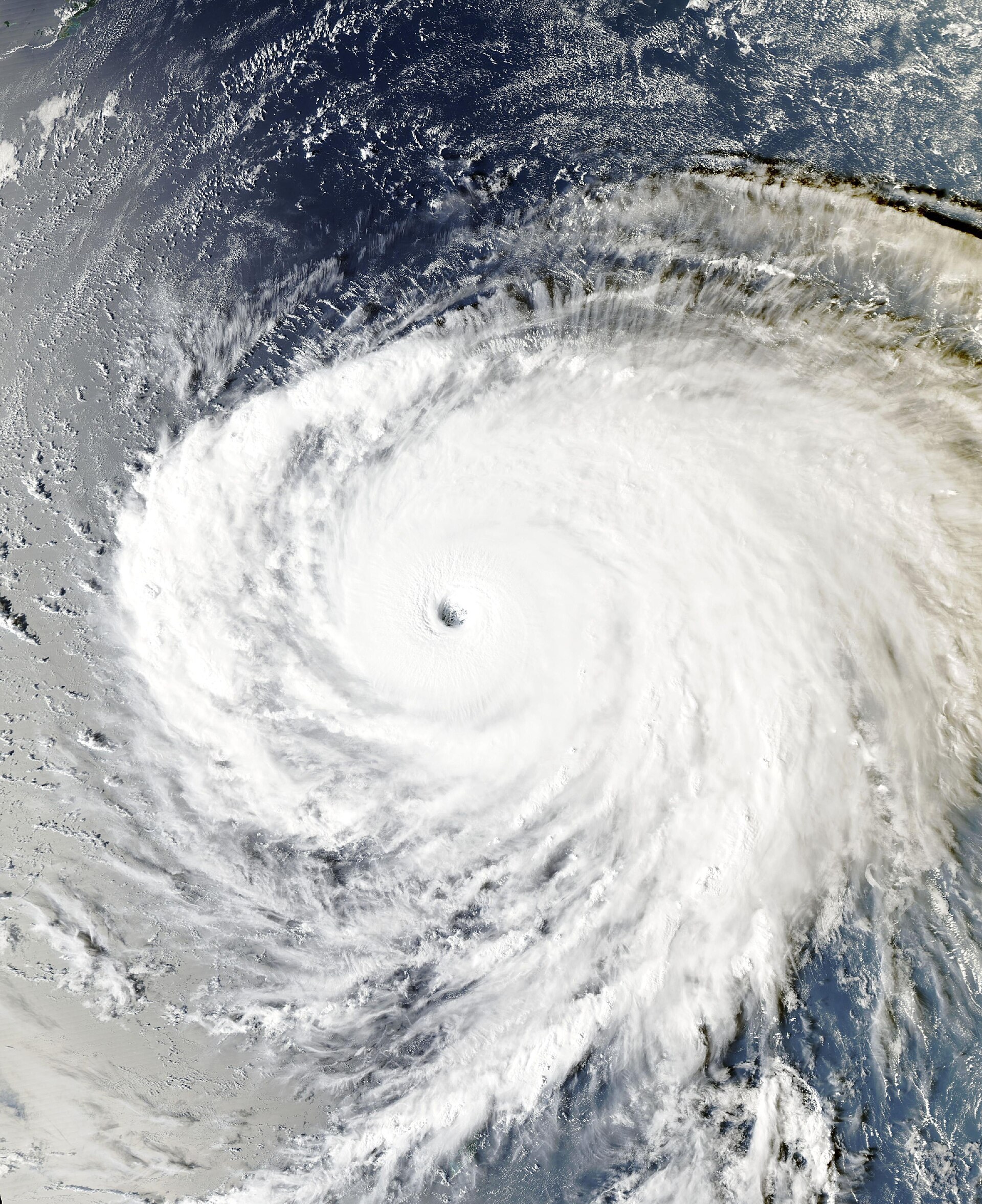
Super Typhoon Champi is the strongest storm on Earth this year, and it is heading toward Taiwan, Japan's southern islands and possibly mainland Japan. Champi peaked at 185 mph sustained winds on Tuesday, Oct. 20, tying April's Super Typhoon Sinlaku as 2026's strongest storm, and it is forecast to weaken steadily as it approaches Taiwan and the Sakishima Islands on Friday and Saturday.
As of the Joint Typhoon Warning Center's latest warning, at 00Z Oct. 21 (7 p.m. CDT Tuesday), Champi was about 600 miles south-southeast of Okinawa with sustained winds near 180 mph and gusts to about 220 mph, moving west-northwest at about 17 mph. JTWC estimated seas near the center as high as 70 feet.
Where is Super Typhoon Champi going?
JTWC's forecast keeps Champi on a west-northwest track through Thursday, then has it slow and turn north and northeast between Taiwan and Okinawa, heading for Kyushu, Japan, by about Oct. 26.
| Forecast time (UTC) | Position | Max winds |
|---|---|---|
| Oct. 21, 00Z (now) | 18.1N, 130.1E | 155 kt (~180 mph) |
| Oct. 21, 12Z | 19.3N, 128.0E | 145 kt (~165 mph) |
| Oct. 22, 00Z | 20.5N, 126.3E | 130 kt (~150 mph) |
| Oct. 23, 00Z | 23.1N, 124.1E | 115 kt (~130 mph) |
| Oct. 24, 00Z | 26.8N, 123.6E | 85 kt (~100 mph) |
| Oct. 25, 00Z | 31.4N, 127.1E | 55 kt (~65 mph) |
| Oct. 26, 00Z | 34.7N, 134.0E | 40 kt (~45 mph) |
Source: JTWC warning 27. The center calls its track and intensity forecasts low confidence.
Will Champi hit Taiwan?
That is the big question. JTWC says forecast models split sharply after Wednesday. Traditional physics-based models, including the American GFS and European ECMWF, show a "straight-running" track west-northwest with landfalls in Taiwan and China. AI-based models, including Google DeepMind's, show the storm curving northeast toward Japan. JTWC sided with the AI models, noting they have "proven correct in a past storm with a very similar atmospheric setup," but warned of significant uncertainty.
Taiwan's Central Weather Administration said Champi will be closest to the island from Friday, Oct. 23, to Saturday morning, Oct. 24, under any track, the Taipei Times reported. A sea warning could be issued Wednesday evening, and forecaster Tseng Chao-cheng said "the storm's trajectory would determine whether a land warning is to be issued" Thursday night, potentially covering northern Taiwan and Yilan and Hualien counties.
Even without a direct hit, Champi is combining with a strengthening northeast monsoon to bring heavy rain to northern and eastern Taiwan, peaking Friday, with waves up to about 20 feet off the east coast, Orchid Island and Green Island.
What about Okinawa and Japan?
Japan's Sakishima Islands, including Ishigaki and Miyako, could see heavy rain, destructive winds and high waves between Oct. 23 and the morning of Oct. 24, according to Weathernews. FOX Weather said the Ryukyu Islands, Okinawa and northern Taiwan are all under threat later this week. If JTWC's recurving track holds, Champi would then cross the East China Sea and reach Kyushu around Oct. 25 to 26 as a much weaker storm beginning to lose its tropical characteristics.
How strong will Champi be when it gets there?
Much weaker than now, but still dangerous. JTWC expects rapid weakening over the next day as Champi moves over water with less heat and slows down, churning up cooler water from below. It forecasts roughly 150 mph by Thursday morning Asia time and about 130 mph by Friday, then a steeper decline in the East China Sea as dry air and wind shear take hold.
What happened when Champi passed Guam?
Champi's eye passed about 10 miles south of Merizo, at Guam's southern tip, early on Oct. 18 local time, as a Category 4-equivalent typhoon with gusts up to 150 mph. About half the island lost power, the Ugum water treatment plant shut down after flooding, and three people were treated for minor injuries and released, The Watchers reported, citing Guam agencies. Guam Gov. Lou Leon Guerrero reported minimal damage, FOX Weather said, and a presidential emergency declaration allowed FEMA to coordinate federal help. Champi was upgraded to a super typhoon shortly after the pass.
Why is Champi so strong?
JTWC described Champi as having a well-defined eye, a symmetrical cloud canopy and a near-perfect environment: very weak wind shear, sea surface temperatures of about 84 to 86 degrees Fahrenheit, deep ocean heat and strong outflow. Its 185 mph peak ties Sinlaku, which reached the same strength southeast of Guam in April before its eyewall struck Tinian and Saipan.
This story will be updated as JTWC, Taiwan's Central Weather Administration and the Japan Meteorological Agency issue new forecasts. Times are in UTC unless noted; 00Z is 7 p.m. CDT the previous day.